
November 2-3: Heading down the Tennessee-Tombigbee Waterway (Ten-Tom for short)
The Ten-Tom Waterway connects the Tennessee and Tombigbee Rivers. This Waterway was only completed in 1985 at a cost of $2 Billion after many delays. More earth was removed to create the waterway than was moved for the completion of the Panama Canal. Construction of the Ten-Tom shortened the time for commercial vessels traveling from Pensacola, FL to Chattanooga, TN by 720 miles. For pleasure boaters this means not having to navigate the mighty Mississippi which is predominately the domain of large commercial craft.
We spent the next two nights just south of Tupelo, MS as the weather turned cold and rainy. Historical note: Tupelo is the birthplace of Elvis.
November 4: From the starting point on the Ten-Tom, we are 414 feet above sea level. Translation: we need to be lowered via 12 Locks to get back to sea level.. Several boats joined us for the first Lock. As we had three more Locks in close succession, we had a flotilla for the day. After the fourth Lock, the faster boats pressed on while four of us turned into the Smithville Marina. This one won the "Bates Marina" prize. So called after the Bates Motel in Hitchcock's Psycho. Seven of us piled into the marina's "courtesy car" and headed out to the only local restaurant. The restaurant proved to be a nice surprise even though it was located in one of the "dry counties" i.e., no booze. We were, however, lucky that the car made it there and back in one piece.
The Ten-Tom is full of submerged trees, stumps and logs that were not removed when the area was flooded to create the Waterway. So boaters need to be vigilant at all times to avoid damage to the boat.

Some of the trees have survived and provide nesting spots for the many birds that inhabit the waterway.

Baffles were constructed in many locations to prevent creeks from rushing into the waterway too fast.

It is not all tree stumps and baffles.

But there were quite a few!

Another riverfront home on stilts. Prepared for flooding!
November 5: Another day, another four Locks! The same group of four boats departed and transited the next Locks together. Fortunately, the most of the locks are at the beginning of the Waterway so we will have fewer further down the river. Our destination today is Columbus, MS. Columbus served as a hospital center for both Union and Confederate wounded and escaped much of the devastation of the war. Many fine antebellum homes have survived including Tennessee William's.
November 6: As bad weather is in the forecast for the next few days, we decided to press on down river. This section has few marinas and good anchorages are few and far between so careful planning is required especially as the daylight hours are now shorter. We reached our target anchorage with just enough daylight left and were fortunate to raft with fellow Looper Carolyn Ann. We shared a bottle of good red wine and solved the problems of the world.
November 7-8: To Demopolis, AL Fog prevented an early start. But we left to travel the short distance to our next Lock with Carolyn Ann. We are now in the Black Warrior River section of the Ten-Tom which we will follow all the way to Mobile, Alabama and the Gulf of Mexico. We spent two nights in Demopolis. Time to provision do laundry and a few boat chores.

Spectacular White Cliffs of Epes en route to Demopolis.
November 9: Today we had a long run, 72 miles to Bashi Creek. There are not many anchorages on this section of the river and we had to ask ourselves if indeed this was one! We entered this small creek which had five to six feet of water at normal pool and slowly edged our way in. Quite a tight spot but our anchor held and we had an uneventful night.
November 10: Today was a short run only to Bobby's Fish Camp which is a no frills dock and restaurant. Fried catfish is the local specialty along with everything else that can be fried. As the dock is only a hundred feet long, boats that arrive later in the day have to raft to those attached to the dock. During our stay, boats were rafted three deep.

The rafting process underway. A total of 12 boats was the final tally.
November 11: Early morning fog again delayed our departure. Eventually all twelve boats departed for the last and final Lock on the river.

The last Lock that we had to traverse. Fellow boaters waiting to be lowered down.

This is a floating bollard. I should have explained the process before but here is how it works: After entering the Lock at extremely slow speed, the Captain maneuvers up to one of the floating bollards. The Admiral loops a line around the bollard and brings the line back to a cleat on the boat at mid-ship. The water in the Lock is slowly released. The bollard floats down with the boat as it is lowered to the bottom of the Lock. The line is held during this process and is never supposed to be tied off. Once the gates open and the all clear is sounded, the line is released and we are on our way.

Leaving the Lock.

The dam on the downside of the Lock that controls the water flow.
November 12: Down stream to Mobile: The Blackwater makes numerous twists and turns as it flows down to Mobile, Alabama.


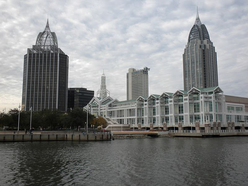

After a delay waiting for a 4 feet railway bridge to open, we cruised into Mobile harbor at 8 knots. After months of not thinking about tides, we now have to pay attention to tide tables and ocean current. Mobile harbor is a busy place. Tows/tugs and barges maneuvering about everywhere. This is a photograph of our GPS system as we transited Mobile harbor. We are the small boat in the center. The red triangles are Tows/tugs with barges. This is how the Automatic Identification System (AIS) shows commercial ships on the GPS. As you can see, there were a lot to contend with.


No comments:
Post a Comment