Wednesday, August 24, 2011

AUGUST 18-24 FRANKFORT TO PENTWATER

August 18 & 19: Frankfort:  Weather prediction for today is for calm seas at least in the morning so we were up and underway by 7:30 a.m. heading for Frankfort.   We had a pleasant transit to Frankfort.  This section of the Michigan coast is scattered with huge sand dunes. 
Example of the large sand dunes along the coast.

We entered Frankfort via a long seawall into a well protected harbor.
Frankfort Light.

Frankfort is yet another delightful small town.  We met an interesting older gentleman here who has been farming in the area all his life.  He regaled us with stories about the town and its history.

Not your typical multiplex theater.

Downtown Frankfort is thriving-at least in the summer.

One of the locals who visited our boat.

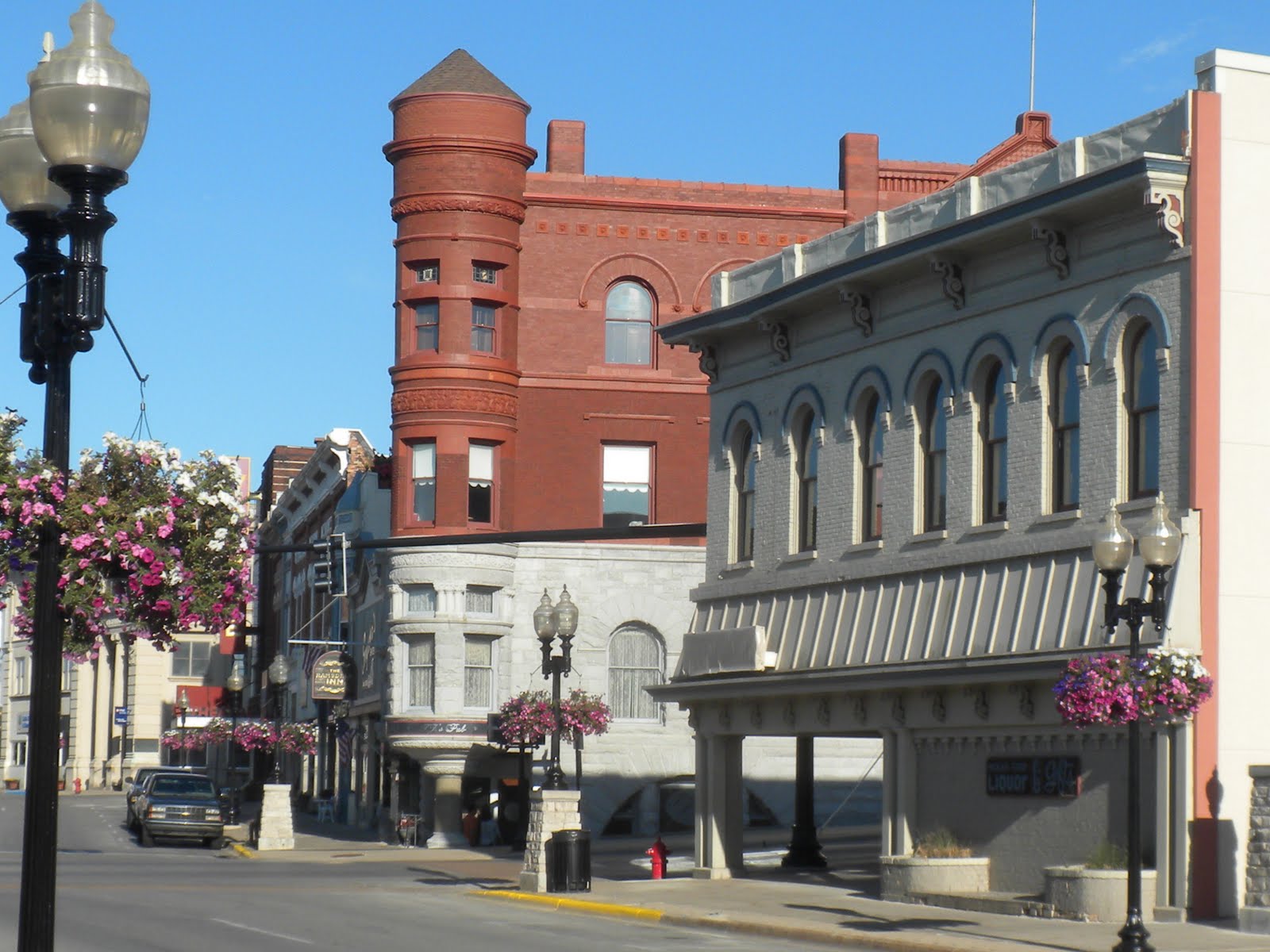
August 20-21:  Manistee:  Good weather is on tap today so we left early for Manistee.  Manistee began as a lumber town around 1840.  By 1896,  Manistee was one of the richest towns in America with a population of 10,000.  Today, it maintains its beautiful Victorian architecture but has fallen on hard times with many stores and restaurants shuttered.  Some of the locals that we spoke to indicated that the Casino that is located about 5 miles away has siphoned commerce away from the downtown.


Downtown Manistee with well preserved Victorian era buildings.

The town has a newly renovated municipal marina which is located along the river.

The town has also invested considerable funds in a river walk that is delightful and well maintained.  We hope that their economic developments are successful as it really is a quaint town.

August 22-24:  Pentwater:  As our travels are so weather dependent, we again took advantage of a good weather window and headed out for Pentwater.
The seawall leaving Manistee.  This one of a kind elevated wrought iron walkway was built so that the lighthouse keeper can have access when the the waves are higher than the seawall!  We were glad that we did not have to deal with waves that large today.

As the municipal marina did not respond to our call, we checked into Snug Harbor marina which is a little further up the river and very sheltered.  It turns out that this was a good choice as the municipal marina is old and does not have the greatest facilities.

Snug Harbor Marina at sunset.

Pentwater is a thriving town with a real buzz and lots of visiting fishermen to boost the local economy.

We had hoped to spend two nights at Pentwater but the weather has turned bad with strong winds and high seas so we are stuck here for at least three nights maybe three.  We will see if the weather improves tomorrow-Thursday!

Wednesday, August 17, 2011

AUGUST 11-17: BEAVER ISLAND TO LELAND

August 11 -12:  Today, we left Mackinac Island and entered Lake Michigan.  Our route takes us under the Mackinac Bridge.  It is a suspension bridge which connects the non-contiguous Upper and Lower peninsulas of the State of Michigan. Opened in 1957, the bridge (familiarly known as "Big Mac" and "Mighty Mac") is the third longest in total suspension in the world and the longest suspension bridge between anchorages in the Western hemisphere.

At 4 miles long and 135 feet high, it is quite impressive.  The bridge marks the point that separates Lake Michigan from Lake Huron.  Lake Michigan is one of the five Great Lakes of North America and the only one located entirely within the United States. It is the second largest of the Great Lakes by volume and the third largest by surface area, after Lake Superior and Lake Huron.   At 923 feet, Lake Michigan is the second deepest lake.

Lake Michigan is also renown for the number of shipwrecks that lie at its bottom: there are reported to be three thousand!  The prevailing winds are from the West and can create treacherous weather very quickly especially on the Eastern Coast.  We, therefore, have to pick our travel days very carefully.  Fortunately, the weather was favorable today so we made our way to Beaver Island.

Beaver Island which is the largest island in Lake Michigan is the complete opposite of Mackinac Island. Totally unpretentious and laid back with very friendly locals. Beaver Island is the most remote inhabited island in Lake Michigan with a year round population of 600-with a large number of Irish descent. Many Irish immigrants came to Beaver Island after being evicted from their homes in Ireland by the local Laird.
 We rented bicycles and toured the island.  Here is Peter with his 7 speed bicycle..none of the speeds worked too well.

Here is Maureen with the  one speed "yellow slug" (definitely not the red rocket from her youth).  Note the Christian Dior cycling outfit!  Not too stylish but it keeps the sun off.

The big time bank in this delightful small town.

August 13-14:  Charlevoix:  We left Beaver Island on what was reported to be a calm day:  winds 5 knots and calm seas.   However, as soon as we left the sheltered harbor, we were rolling around because of the beam seas that were definitely not generated by 5 knot winds.  We had an uncomfortable 5 hour ride to Charlevoix.   When we finally arrived at Charlevoix, we missed the Bascule Bridge opening by a few minutes and had to tread water in a narrow, choppy channel with a lot of current for about 25 minutes.   We survived but were exhausted when we finally arrived at the marina.

The weather was great the next day so we explored Charlevoix.   The municipal marina was great-recently renovated.  Charlevoix is often compared to Newport, RI with its quaint stores and art galleries.  It is a popular summer vacation spot for the rich and famous from Chicago.

Peter spotted this memorial to the submariners who lost their lives during WWII on their maiden voyage.  Being a former submariner, he always has his eye out for historical memorials relating to submarines.

August 15:  To Sutton Bay

Leaving Charlevoix, we could planned our departure better so we made the Bascule Bridge opening with only a few minutes waiting time.

The narrow channel into and out of Charlevoix.

 We left Charlevoix on a perfect cruising day-very calm seas and no wind.  The cruise today was only 20 miles so we arrived in Sutton Bay with time to explore the charming downtown.

Downtown Sutton Bay.

August 16-17:  Leland:  The weather gods smiled on us again today and we had another day of calm seas for our transit to Leland.  We plan to spend two nights here as the weather is predicted to turn bad for Thursday, August 18.
Leland is a picturesque little village located on a sliver of land between Lake Michigan and Lake Leelanau.  Leland's historical district, know as Fishtown, features rustic shanties and docks reminiscent of life and commercial fishing one hundred years ago.  The town is separated by the Leeland River which connects Lake Leelanau to Lake Michigan.


Friday, August 12, 2011

AUGUST 8-10 MACKINAC ISLAND

After a day of thunderstorms and windy conditions, we finally left Drummond Bay for Mackinac Island on a perfect traveling day:  flat seas and blue skies!

Michilimackinac-meaning the place of the great turtle, that is what the Great Lake Indians called the island that separates Lake Huron from Lake Michigan.  Like many locations, Mackinac Island has experienced many evolutions:  from furs to fudge.  Once a major trading post for furs, current day Mackinac is now a major tourist destination.  In the late 1900s, under pressure from the carriage drivers,  the village council banned the use of automobiles on the island.  This act preserved Mackinac's carriage tour economy and late 19th Century atmosphere.   So how do people get around?

Lots and lots of bicycles and tourists.

Horse drawn carriages.

Everything is hauled by horse and cart.  A whole crew is employed to clean up the horse droppings.

The huge number of tourists are brought in by high speed ferries.  We were amazed at the number of ferries entering the harbor-most were not too careful about reducing their wakes so we got bounced around a lot at our slip in the town marina.

One of the attractions of Mackinac Island is the well preserved architecture.  By the 1890s, magnificent mansions were constructed as the island became the most fashionable summer resort in the Great Lakes.
Some examples of the well preserved houses all with manicured gardens and an array of colorful flowers.


One of the other major attractions is Fort Mackinac. 

The Fort served as a military post for the British and later American soldiers from 1780 to 1895. In the early years, Fort Mackinac was a crucial border post. It protected the lucrative fur trade and maintained alliances with neighboring Indian tribes. Today, military reenactments are for the hordes of tourists.


One of the many cannons in the Fort.
View of the harbor from the Fort.

In 1887, the immense and palatial Grand Hotel opened its doors on Mackinac. 

The Grand Hotel has hosted many Presidents and boasts that it has the longest veranda in the world.  Non residents must pay $10 to tour the hotel. After 6:00 p.m. men must wear a suit and tie and ladies are not allowed to wear slacks. As we had left the tiaras and tuxedos at home, we opted to indulge in their extravagant brunch instead.


Guest transportation at the Grand Hotel.

We had originally planned to only spend two nights on Mackinaw but weather predictions for high winds, 5-8 foot seas and water spouts made us opt for another night.  The next day, we rented bicycles (had to work off that large brunch!) and cycled around the perimeter of the island-8.5 miles.

Bike path around the island.

Monday, August 8, 2011

JULY 27 TO AUGUST 7 GEORGIAN BAY TO THE NORTH CHANNEL

July 27:  Parry Sound to Katsilano

Sunrise in Parry Sound Marina.  After provisioning in Parry Sound, we left on a beautiful, sunny and calm day.  Our destination today is Katsilano which looks to be a quiet anchorage.  Our route took us through the Canoe Channel which is very picturesque but very shallow and rocky as well as requiring many very sharp 90 degree turns-sort of like hairpin turns on the water! 

The Canoe Channel-lots of rocks.  Some charted some not, vigilance required! (photo courtesy of Glory Days)

Pointe Au Baril Lighthouse

After an uneventful trip, we arrived in Katsilano Bay to anchor for the night.

July 28:  Katsilano to Byng Inlet:  We left the next day for Byng Inlet and arrived in Wrights Marina after noon.  Time to do some laundry-we have two types of clothes on the board:  clean and dirty.

July 29:  Onward to the Busterds:  Today, we left the small craft channel and headed out into Georgian Bay proper for the Busterds Island.  We arrived there in the early afternoon to find only one boat there.  It is a relatively small bay so we anchored with both a bow and a stern anchor-the first time for us on this trip.  It is more work but it will give us a more peaceful night's sleep as we will not swing as much. 

The view from our boat of the anchorage at the Busterds.  No that is not a spelling mistake-it is the Busterds with a "u" not an "a".

July 30:  To Killarney

Leaving the Busterds for Killanery-the hills in the distance looked like they were covered in snow.

After yet another uneventful night-always a good thing when at anchor-we went through the process of raising both anchors and departed for Killarney.  We stayed at the Sportsman's Marina which was full of party goers so we were serenaded into the night...fortunately there was a lot of Motown music so we did not mind too much.  

After a great fish and chip dinner at the local restaurant, we walked around the town and took a few photos.  We liked this old stone church.

July 31:  Baie Fine:  After our hectic town marina, we were ready for some peace and quiet so headed off to Baie Fine today.  The scenery today reminded us of traveling through fjords:  high granite cliffs with clear blue water.

Entering Baie Fine

Campers on one of the many rocky outcrops in Baie Fine.  Now that is roughing it.

A cottage in Baie Fine

Our anchorage in Baie Fine-beautiful spot!

August 1:  To the North Channel and Bell Cove:  There are so many islands and anchorages to explore, one really needs 3 months just in Georgian Bay.  Unfortunately, we had to leave Baie Fine and head for Little Current and the North Channel.

Leaving Baie Fine-it certainly lived up to its name. 

After leaving Baie Fine, we entered another narrow channel en route to Little Current.  Parts of the channel were really shallow! 

To enter Little Current, we had to wait for the swing bridge to open.  It is supposed to open on the hour for 15 minutes.  However, the operator seems to have a lot of leeway in interpreting the openings.  We arrived at the bridge with minutes to spare but he closed the bridge on us before the 15 minutes were up.  So we had to hang around in a relatively small area for over an hour to wait for the next bridge opening.  No easy task in a boat where there is considerable current.  Finally we made it through and timed the bridge opening:  just 6 minutes!  We motored through Little Current which should be called Big Current for the amount of current that follows through the place.  Someone had a sense of humor, I suppose. 

We decided not to stay in Little Current and instead headed to an anchorage at Bell Cove.
Bell Cove

August 2:  The Benjamins and Crocker Island:  After a somewhat rolling night at Bell Cove, we headed further up the North Channel to the Benjamin Islands and anchored in Crocker Bay. 

Crocker Bay had a sandy beach that his majesty enjoyed as most of our anchorages have been close to rocky outcrops.

August 3:  Gore Bay:    Time to make the transit back to the USA.  We crossed from the North side of the North Channel to the south side and to Gore Bay.   

Gore Bay has a new marina.  Facilities were great-laundry time again.

August 4:  Meldrum Bay:  This is our last stop in Canada.  It is also our anniversary for being on the trip for two months.  To celebrate that we are still married and enjoying ourselves, we went out to the only restaurant in Meldrum and had an excellent fish dinner.

Meldrum Bay Inn

Sunrise in Meldrum Bay.

August 5-7:  Back to the USA:  We left Meldrum for Drummond Bay which is our first stop back into the USA.  Once we cross into US waters, we lowered the Canadian flag and raised the yellow quarantine one which we keep hoisted until we clear US Customs.  We arrived around noon, docked and were checked out by US Customs within the hour-so time to raise our big American flag.
We had planned to spend two nights at Drummond before departing for Mackinac Island but bad weather on Sunday, August 7 kept us there for another day.  Oh well, time to read some books and wait out the rain and thunderstorms.  We have had incredible weather to date and this is the first time that we have not been able to leave as planned.

Drummond Harbor Marina

His Majesty enjoying a day off from all the hard work entailed with supervising the two legged ones.